zoom_in Drag to zoom
Texas Ecoregions Map
$0.00 / unit
info_outline Shipping options will be selected during checkout.
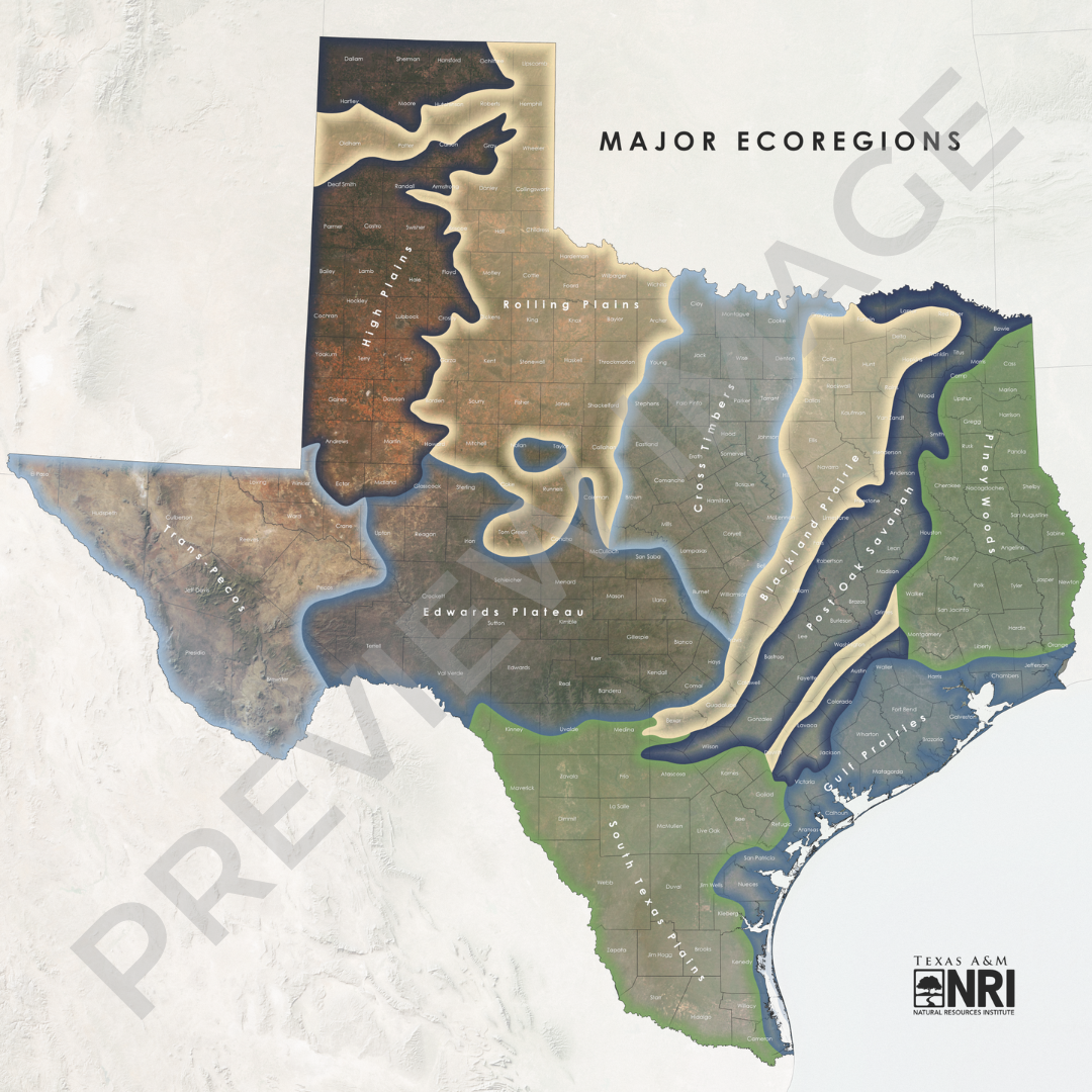
This map shows the major ecoregions of Texas—defined areas that are generally similar in ecosystems and in the type, quality, and quantity of environmental resources. Gould’s ecoregions include the Blackland Prairie, Cross Timbers, Edwards Plateau, Gulf Prairies, High Plains, Piney Woods, Post Oak Savannah, Rolling Plains, South Texas Plains, and Trans-Pecos. Data modified and map created by Garrett Powers, Texas A&M Natural Resources Institute in 2023.
Source: Gould, F.W., Hoffman, G.O., and Rechenthin, C.A. 1960. Vegetational areas of Texas, Texas A&M University. Texas Agricultural Experiment Station, Leaflet No.492
Digital download instructions:
To purchase and download a high-resolution digital file of the map,
- Please select “Digital Download” from the dropdown menu below to purchase.
- Forward your order confirmation email to [email protected].
- Your digital file will be emailed directly to you.
Please note that this digital file is for personal use only and may not be adapted, altered, or sold.
Printed map instructions:
To purchase a printed map,
- Please select the map size from the dropdown menu below and note the price differences.
- All purchased map orders will be printed on cloth canvas unless otherwise requested via email to [email protected].
- The cost of the protective materials and poster tube used to ship your map is included in the price shown.
- A $10 shipping charge will be added at checkout.
- If pickup is requested, we will email you when your poster is ready at Texas A&M NRI (1001 Holleman Dr. E, College Station, TX 77840).
Digital map files will be sent within 1-2 business days. Posters will ship within 5-7 business days. Please get in touch with us at [email protected] with any questions.
All map proceeds will support the work of our geospatial analysis team and the information and resources shared on The Land Steward Podcast, produced by the Texas A&M Natural Resources Institute.