zoom_in Drag to zoom
Texas Historic Cattle Trails Map
$0.00 / unit
info_outline Shipping options will be selected during checkout.
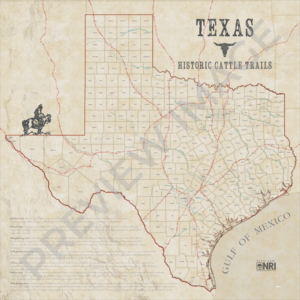
Texas has greatly evolved since officially joining the US over 150 years ago, yet remnants of what defined our state in centuries past can still be found. Numerous cattle trails scattered the state during the 18th and 19th centuries, as cattlemen drove their herds to profitable markets in northeastern states. These drives became a cornerstone in creating the golden age of the cowboy. Ultimately, cattle trailing died out by 1900 due to the invention and enthusiastic use of barbed wire fencing with the spread of cattle tick disease. Even so, Texas’ inherent identity and heritage is built on this unique economy and the foundation and way of life can be found along every familiar road you may take. The cattle trails were drawn as a culmination of trails found across several different historical maps and documents. Data modified and map created by Matt Crawford, Texas A&M Natural Resources Institute in 2022.
Sources: Texas Natural Resource Information System, Texas Department of Transportation, Texas Water Development Board, Texas General Land Office, and Texas State Historical Association.
Digital download instructions:
To purchase and download a high-resolution digital file of the map,
- Please select “Digital Download” from the dropdown menu below to purchase.
- Forward your order confirmation email to [email protected].
- Your digital file will be emailed directly to you.
Please note that this digital file is for personal use only and may not be adapted, altered, or sold.
Printed map instructions:
To purchase a printed map,
- Please select the map size from the dropdown menu below and note the price differences.
- All purchased map orders will be printed on cloth canvas unless otherwise requested via email to [email protected].
- The cost of the protective materials and poster tube used to ship your map is included in the price shown.
- A $10 shipping charge will be added at checkout.
- If pickup is requested, we will email you when your poster is ready at Texas A&M NRI (1001 Holleman Dr. E, College Station, TX 77840).
Digital map files will be sent within 1-2 business days. Posters will ship within 5-7 business days. Please get in touch with us at [email protected] with any questions.
All map proceeds will support the work of our geospatial analysis team.